Project Mapping Ukraine
Background
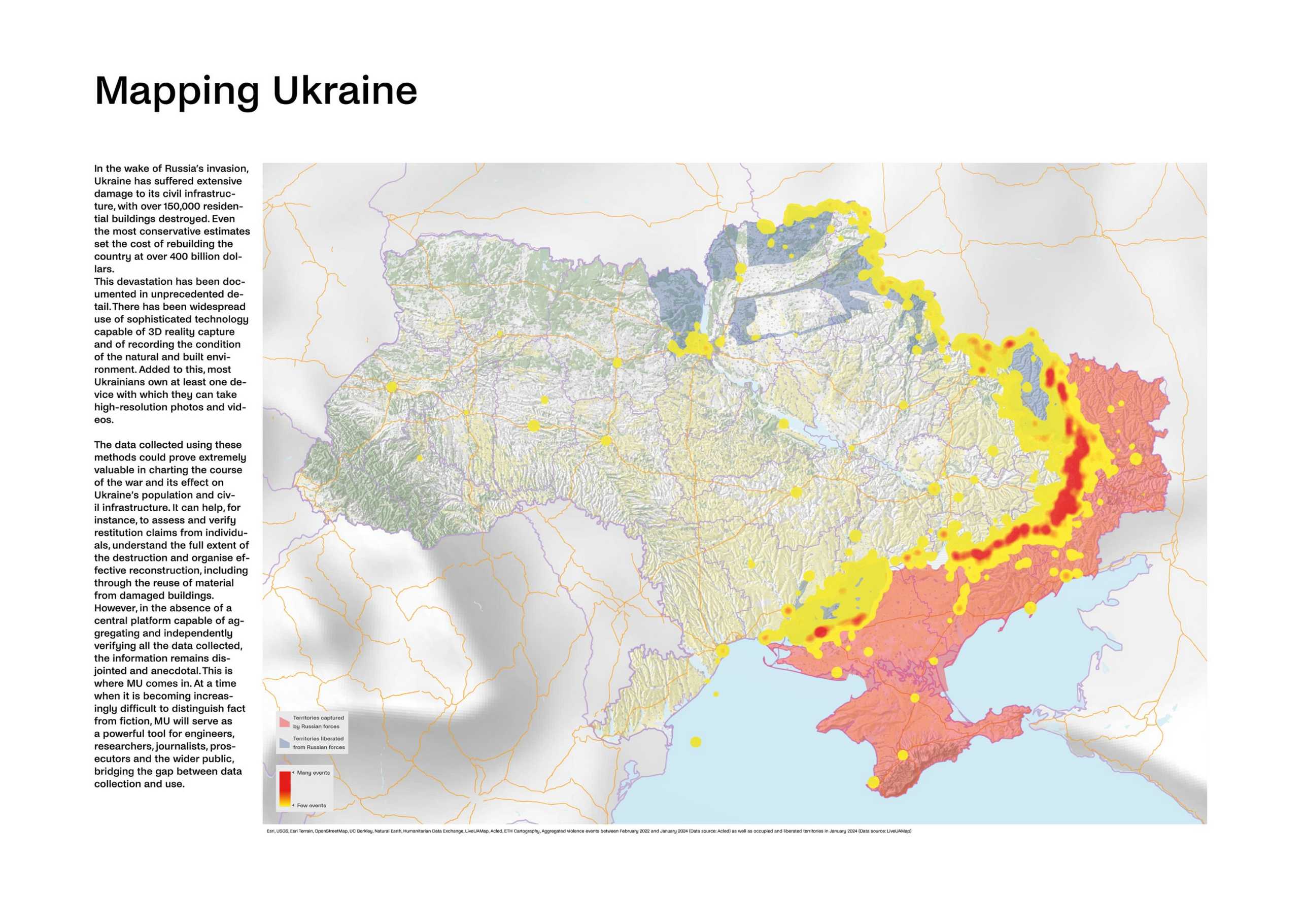
The full-scale invasion of Ukraine by Russia has resulted in overwhelming damage to the country’s civil infrastructure and the destruction of more than external page 1.5 million homes. Even the most conservative estimates set the cost of rebuilding the country at over external page 400 billion dollars. This devastation has been documented in unprecedented detail, from mobile phone footage to sophisticated technology capable of 3D reality capture.
The Platform
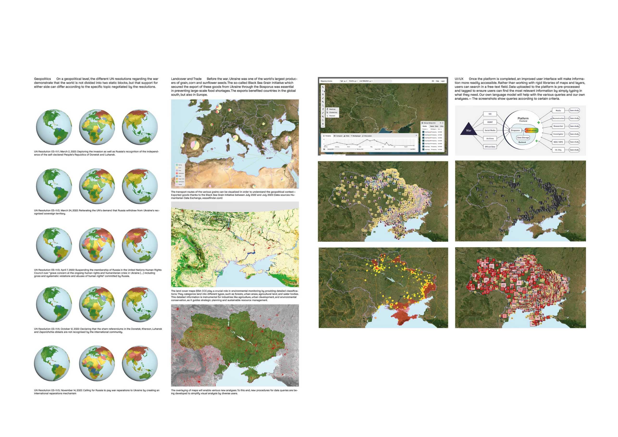
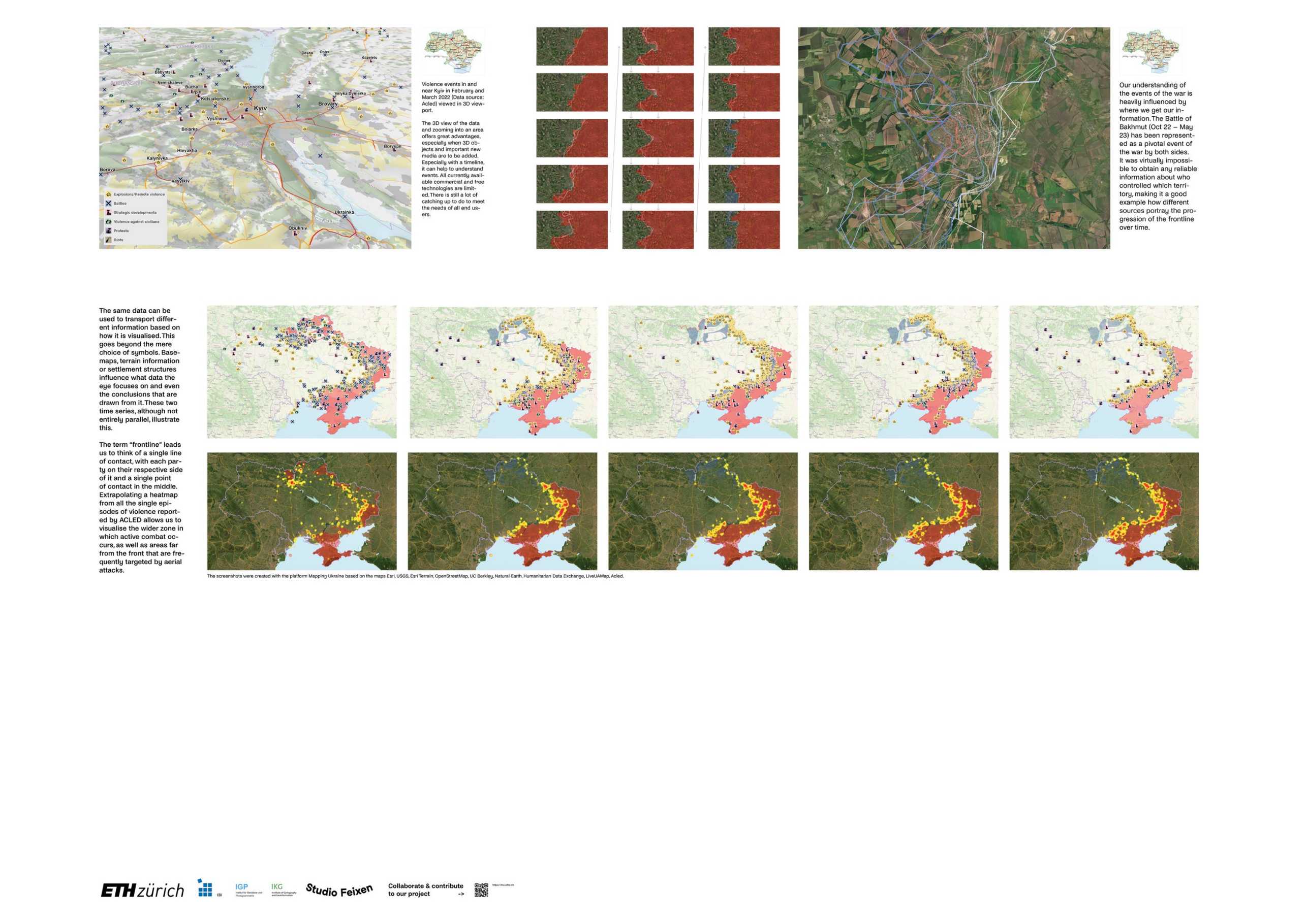
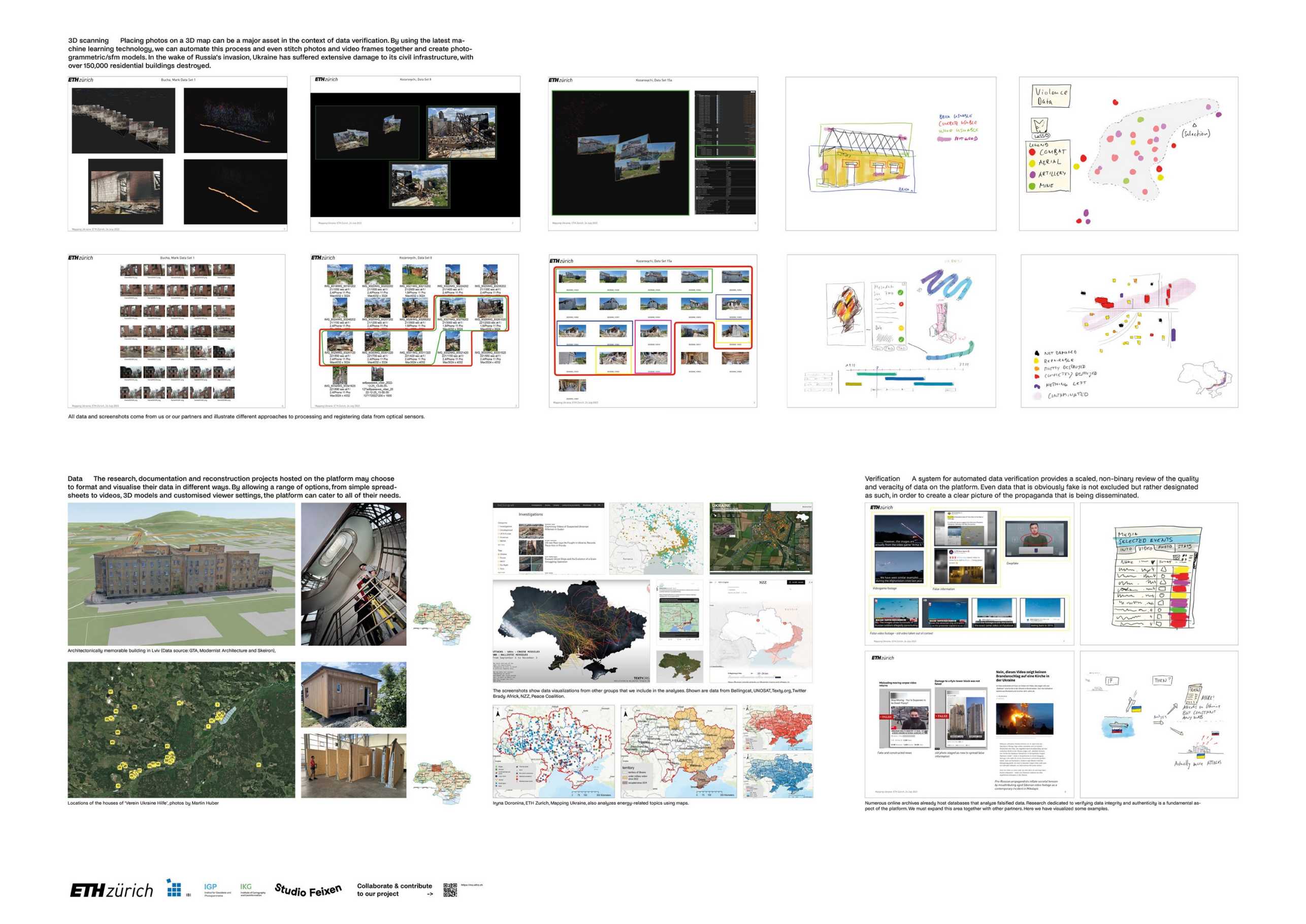
Mapping Ukraine (MU) is a virtual platform initiated at the ETH Institute of Geodesy and Photogrammetry which aims to provide independent, open and intuitive access to information on the impact of war on civilian infrastructure in Ukraine. Using the latest machine-learning technology, images, videos, 3D models, volunteered information and publicly available data are automatically collected, verified, tagged, integrated and made available on the platform. This information constitutes spatio-temporal evidence: a register of damage to be used by professionals such as researchers, engineers, journalists and the broad public. At a time when it is becoming increasingly difficult to distinguish fact from fiction, MU will serve as a powerful archive bridging the gap between data collection and use.
Impact
The data collected using these methods could prove extremely valuable in charting the course of the war and its effect on Ukraine’s population and civil infrastructure. It can help, for instance, to assess and verify restitution claims from individuals, understand the full extent of the destruction and organise effective reconstruction, including through the reuse of material from damaged buildings.
Sustainability
Initiated in response to the invasion of Ukraine, the platform aims to become a versatile tool for recording overall damage and individual losses in other geographical settings. These can include sites of natural disaster, which gain importance in the light of the political debates on remediating the loss and damage resulting from climate change across the Global South.
Contact
Geosensorik und Ingenieurgeodäsie
Stefano-Franscini-Platz 5
8093
Zürich
Switzerland