Education
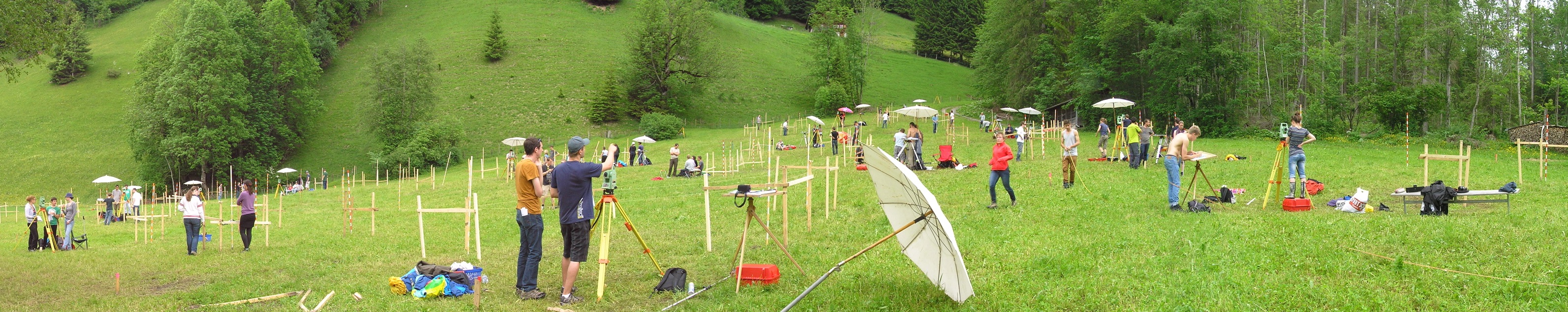
The Chair of Geosensors and Engineering Geodesy educates students of Geospatial Engineering ("Raumbezogene Ingenieurwissenschaften"), Geomatics and Civil Engineering in a variety of courses covering lectures, exercises, field courses and seminars on the topics:
- Geodetic Metrology / Surveying
- Terrestrial Laserscanning
- Engineering Geodesy
- Geodetic Monitoring
- Industrial Metrology
- Parameter estimation
Most of these courses comprise theoretical and practical work, often including programming (using Matlab or Python) for implementing data processing workflows or controlling sensors. We offer the possibility to work on timely and challenging problems related to these areas and to our research within Bachelor's theses, Master's theses and interdisciplinary projects. Further, students have the opportunity to collaborate as teaching assistants or support the group on an hourly basis in research projects and thus also extend a broad range of competences.
Contact
Geosensorik und Ingenieurgeodäsie
Stefano-Franscini-Platz 5
8093
Zürich
Switzerland