Monitoring of the Bisglacier with Terrestrial Radar Interferometry
Overview
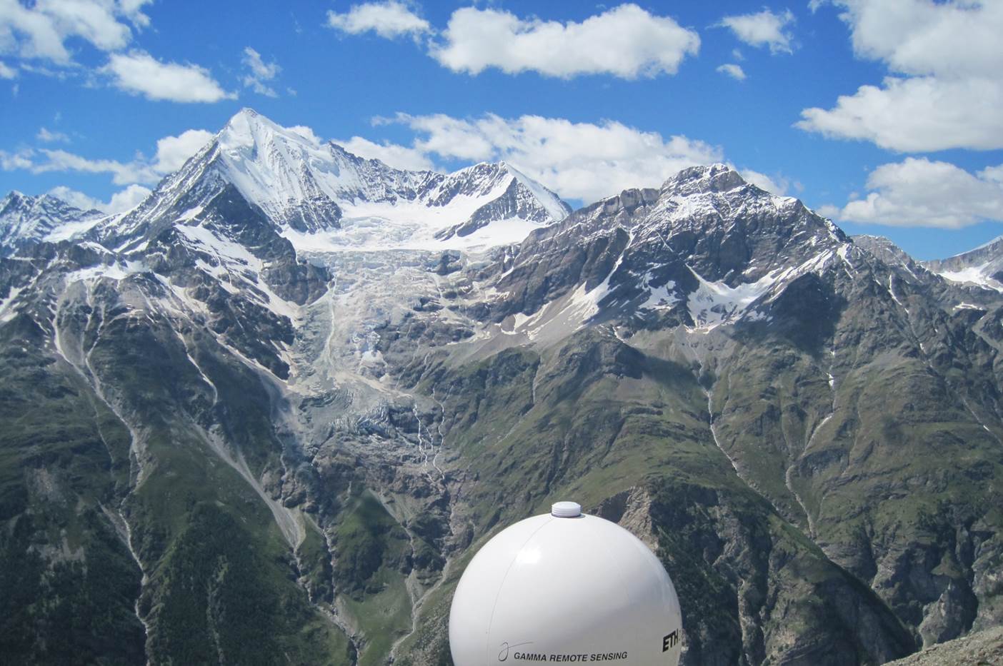
The occurrence of glacial rupture phenomena can pose a severe risk for settlements located further downslope and under certain circumstances may not be adequately measurable by means of conventional surveying instruments and associated data analysis. Especially problematic are estimations of the rupture time, if the thermal regime of the involved glacier admits the existence of liquid water at the glacier bed. Researchers of ETH Zurich carried out a monitoring campaign to assess the aptitude of terrestrial radar interferometry for the derivation of glacial deformation maps and to expand the data available for inferring glacial dynamics. For that purpose, the “GPRI” (an acronym for Gamma portable radar interferometer ) by Gamma Remote Sensing , Switzerland was be used.
Background
Ice avalanches from the Northeast Side of the Weisshorn ( a 4500 m high mountain in southern Switzerlands canton Valais) threaten the village Randa and its critical infrastructure since historical times. Ruptured sheets of ice can induce avalanches, which can reach the village during winter and could possibly obstruct or destroy the canton road and the railway to Zermatt. These events are of an essentially unpredictable nature. Though researchers from ETH and VAW in collaboration with the canton Valais successfully identified two ruptures in advance in the years 1973 and 2005 with conventional geodetic methods, the usage of total stations and GNSS for glacial monitoring is linked with high costs and serious dangers for the participating scientists.
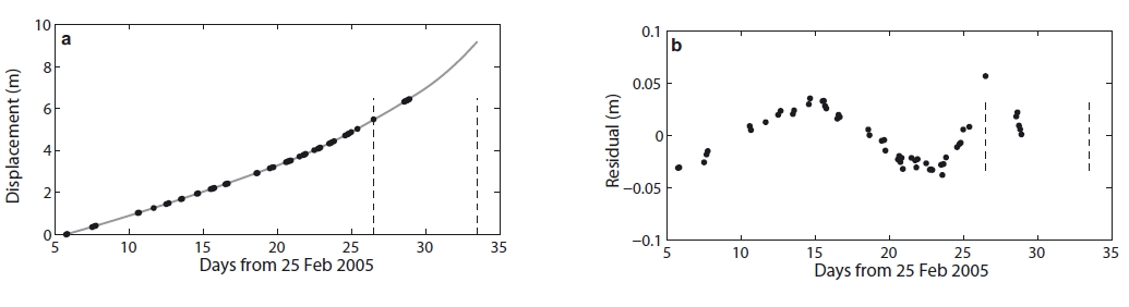
Furthermore, the data analysis is burdened with uncertainties, that can be traced back to material heterogeneity and nonlinearities in rupture process and crack formation. A paper published in 2008 implies the validity of a power law based on the self-similarity of crack formation to estimate the development of velocity over time. Even better predictions especially for the time of rupture can be generated according to the study, if one performs a frequency decomposition of the measured velocities. By following this course of action, a second component contained in the velocity time series is identified to be a sinusoidal oscillation with increasing frequency towards the rupture time. However, a final verification of the proposed model was not possible, because a part of the equipment was destroyed by glacial activity before the actual rupture event. The question is raised, how a glacial monitoring can be realized, that guarantees continuous measurements and the safety of the conducting staff
Radar Interferometry
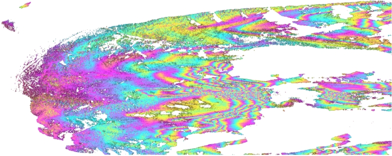
The limitations of classical geodetic measurement devices for the temporally and spatially dense sampling of the Bisgletscher are found primarily in the area of instrument installation, recovery and interpolation of pointwise gathered data. These problems can be mitigated by the usage of a terrestrial radar interferometer, which is specifically designed for long distance measurements and can adopt roles normally reserved for remote sensing techniques. The territory will be sampled with microwaves of a frequency between 17.1 and 17.3 GHz. Each backscattering area will also be associated to a physical quantity called “phase”, which changes reproducible even in the case of small glacial movements and consequently allows the deduction of extensive deformations. The radar interferometer possesses one transmitting and two receiving antennas; if the phase differences of two pictures taken from slightly different positions are analysed, the topographical dependency of the phase difference can be utilized for the reconstruction of a digital elevation model.
Special advantages of the terrestrial radar interferometer for glacier monitoring include the extensive acquisition of movement, a high temporal sampling density and an accuracy of about 0.1mm under optimal conditions. The possibility to create a digital elevation model is useful in the sense that the recognition of long term changes in glacial topography is greatly simplified.
Practice
However, accuracies similar to the values found during laboratory experiments are rarely achieved in practice. This is mainly due to a height-difference induced highly variable atmosphere, which systematically distorts the phase measurements and is to this day still in large parts uncorrectable. The remoteness of the instrument location has to be considered as well: protection against lightning and willful damage is as important as the establishment of a capable infrastructure to enable remote evaluation and control in our facilities in Zurich. The data will be processed to yield geocoded interferograms depicting the motion between two different points in time, when the measurements were performed. This allows the extraction of deformation time series, with which model-based predictions like the velocity evolution over time according to the already proposed power law approach can be validated. An improvement to the models and a direct inclusion of measurements leads to an increased security for the risk assessment and will affect the quality of the monitoring and the safety of the involved localities positively in the long run.


Faillettaz, J., Pralong, A., Funk, M., Deichmann, N.
Evidence of log-periodic oscillations and increasing icequake activity during the breaking-off of large ice masses
(2008) Journal of Glaciology, 54 (187), pp. 725-737
Contact
Geosensorik und Ingenieurgeodäsie
Stefano-Franscini-Platz 5
8093
Zürich
Switzerland