Igloo Village Zermatt
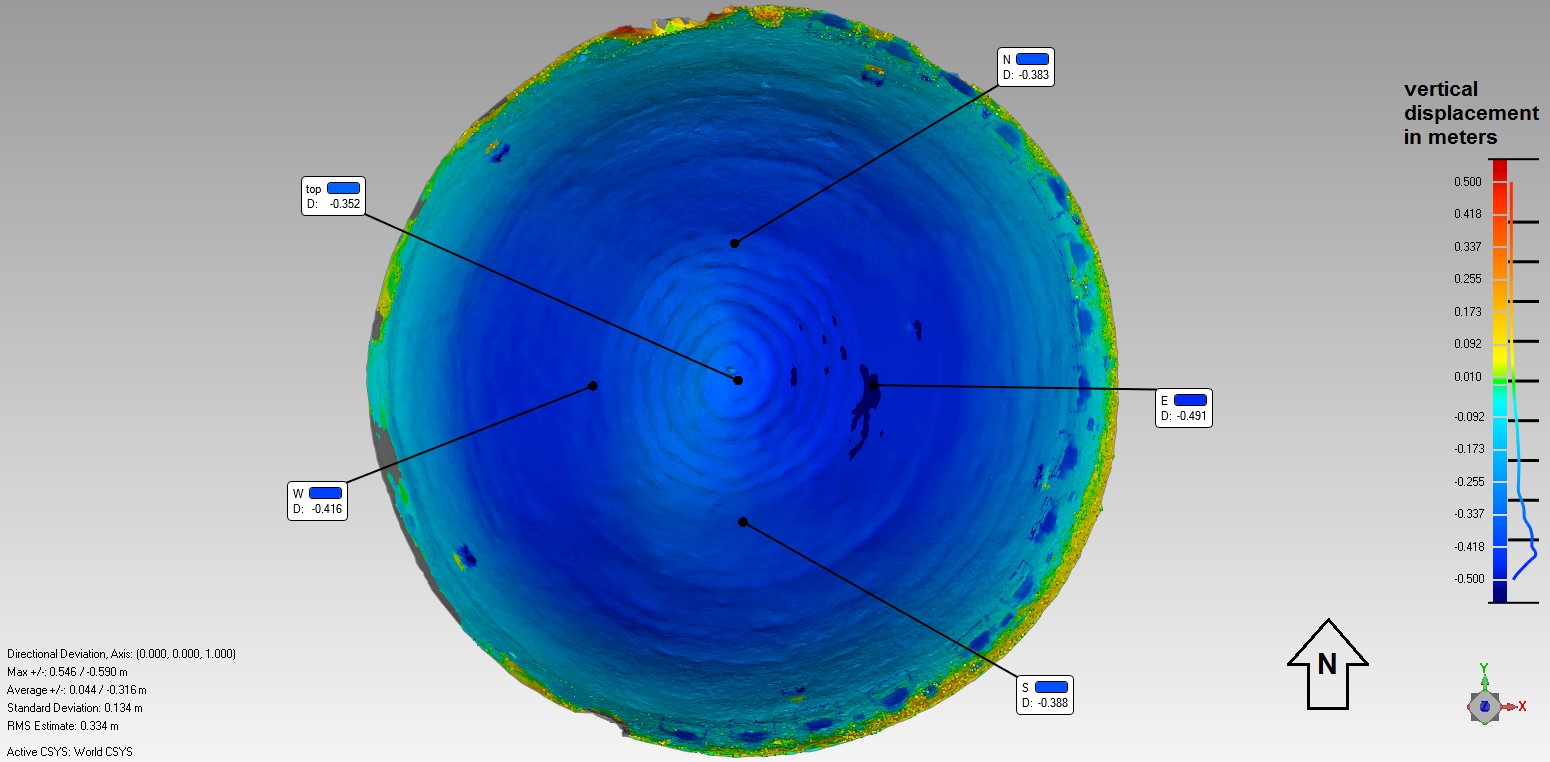
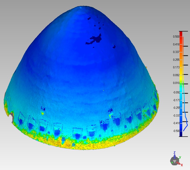
The Chair of Geosensors and Engineering Geodesy of the ETH Zürich was involved in using terrestrial laser scanning (TLS) to monitor the largest igloo ever built, in the Iglu-Dorf Zermatt. This structure deforms really quickly when compared to classical buildings because of the melting and compaction of the snow bricks. Since the rate of deformation is expected to decrease in time, the TLS measurements are performed with a progressively reducing frequency.
Measurements of the geometrical properties of the igloo were performed in 5 epochs spanning different seasons indicative of extremal kinematic behavior. As a measuring device, the compact Faro Focus3D X330 (see figure 1) has been chosen. In order to correctly geo-locate the acquired point clouds, three points placed outside the igloo in locations which are visible from the scanner are also surveyed with GNSS techniques.
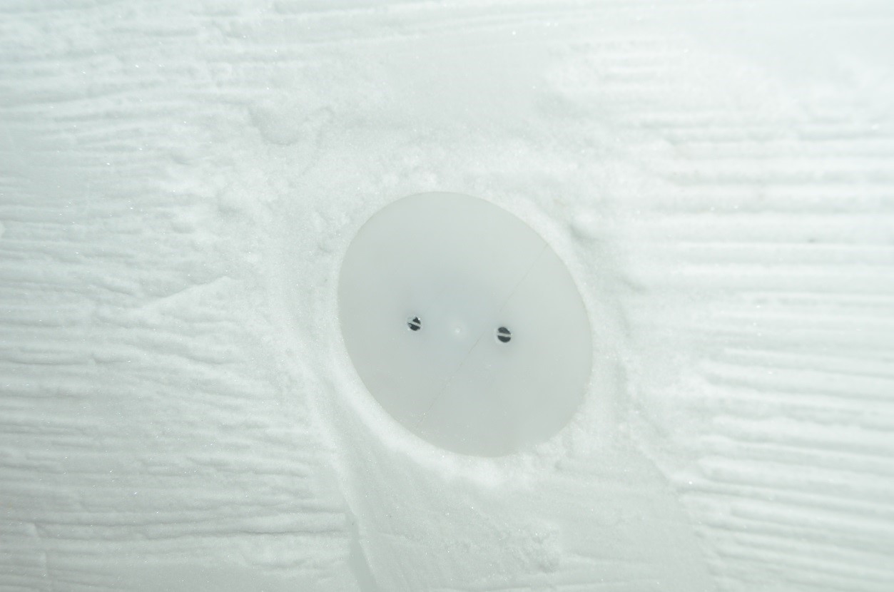
Before the dismounting of the internal scaffolding, 20 artificial targets (see figure 2) have been placed in the igloo dome. The purpose of the installation of these plastic discs is the tracking of some features of the igloo across the various epochs. Moreover, they allowed to investigate the temporal changes of reflectivity of the snow surface having a reference whose material properties are constant in time.
The companies BSF Swissphoto and Planax designed and installed a GNSS system monitoring the pointwise vertical displacements of the top of the dome - live results were visible and, purely for entertainment, betting on deformation rates was possible in realtime. You can also find additional information about the igloo village in general and steps leading to the world record on external page http://www.iglu-dorf.com/events/weltrekord/.

Contact
Geosensorik und Ingenieurgeodäsie
Stefano-Franscini-Platz 5
8093
Zürich
Switzerland