Integrated structural monitoring using point clouds obtained from Terrestrial Laser Scanning
The integration of areal monitoring techniques such as terrestrial laser scanning (TLS) and the numerical simulation of complex structures is a challenge in the context of Structural Health Monitoring (SHM). Key aspects to facilitate this integration are the thorough handling and modelling of the uncertainties of both measurement and numeric model, and the understanding of the sensitivity of the areal measurements with respect to the investigated structural parameters.
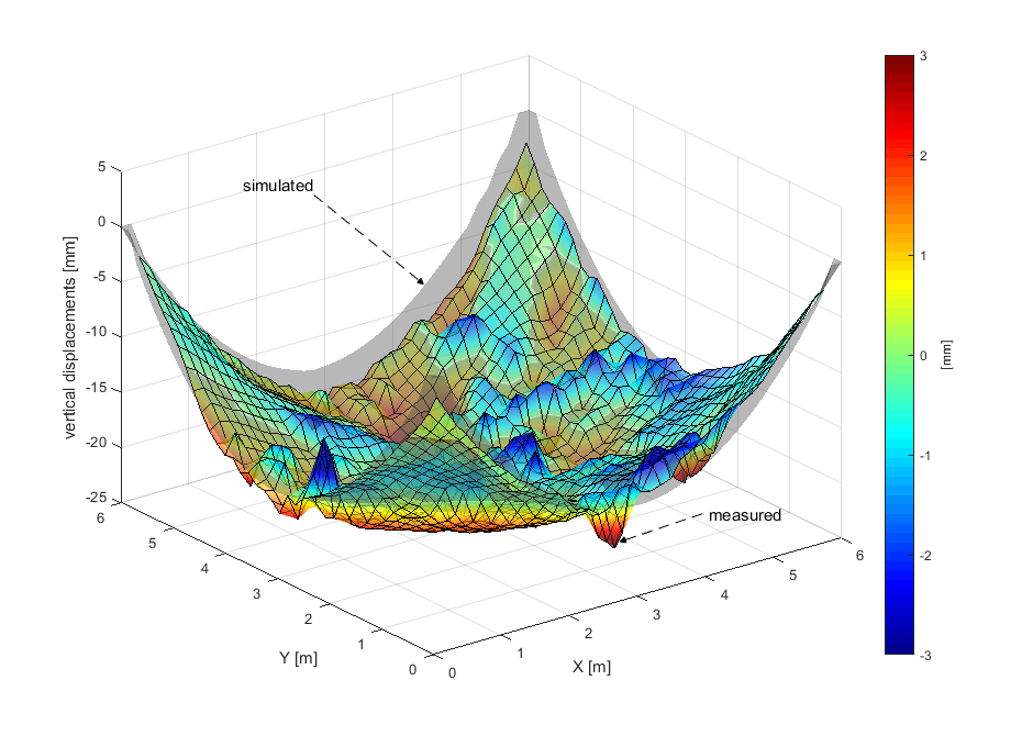
We developed an algorithm that integrates the contactless areal monitoring of a free form structure and the numerical determination of its material parameters with a finite element (FE) model. The FE mesh is generated automatically from a point cloud acquired using TLS, while the best linear unbiased estimates of the desired material parameters are calculated by matching the displacements calculated with the FE model to the ones measured on the actual structure.
At the moment, we are expanding the algorithm by automating the parameter estimation, assessing quantitatively the sensitivity of the input data with respect to the sought parameters, quantifying the sensitivity of the estimated parameters, and validating the correctness of the algorithm with a closed-loop test, using simulated deformations obtained from a chosen FE model.
As an application example, we chose to estimate the Young and shear moduli of a bent slab made of cross-laminated timber (CLT), whose glued connection has been investigated by the Institute für Baustatik und Konstruktion of ETHZ.

Contact
Geosensorik und Ingenieurgeodäsie
Stefano-Franscini-Platz 5
8093
Zürich
Switzerland