Modelling surface-related uncertainty of terrestrial laser scanning
The 3D coordinates obtained by terrestrial laser scanning (TLS) are subject to uncertainty, which needs to be quantified in order to properly interpret the results, check the accuracy of the point cloud or use it for critical decisions. The primary aim of this PhD project is to develop a numeric model of the distance measurement process for TLS and use it for sensitivity analysis and accuracy prediction.
The numeric model of the reflectorless opto-electronic distance measurement (RL-EDM) based on quantitative simulations has been developed for the prediction of the expected bias and random noise of an individual distance measurement taking into consideration (i) the beam parameters, (ii) the surface topography within the beam footprint, (iii) the material properties within the beam footprint, (iv) the geometric configuration in terms of distance and angles of incidence, and (v) the measurement principle of the instrument (both continuous wave and pulsed based detection).
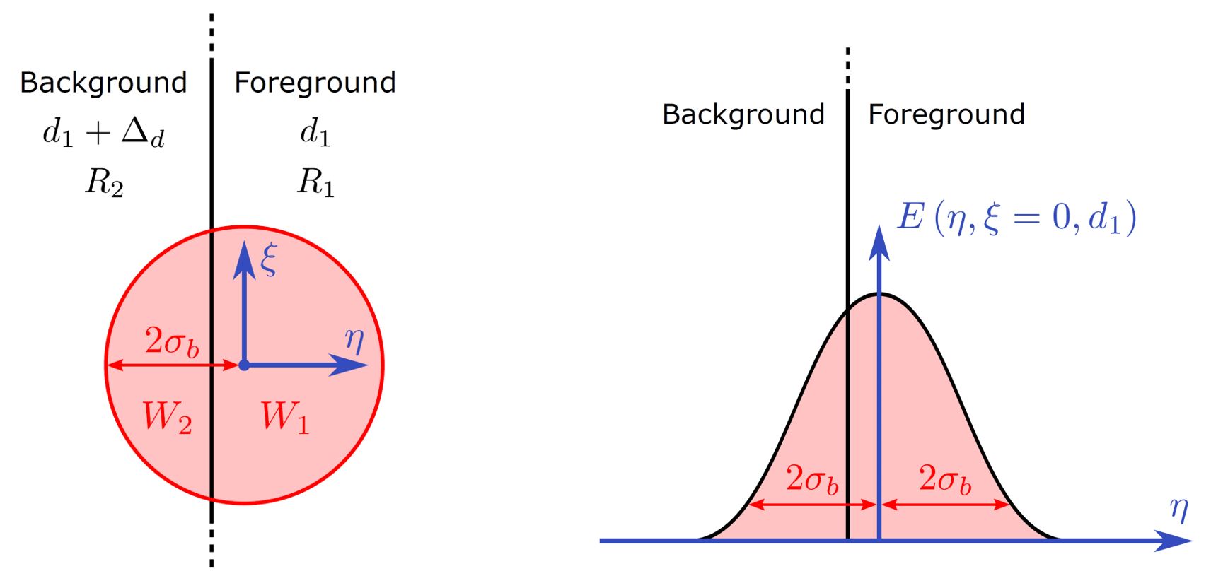
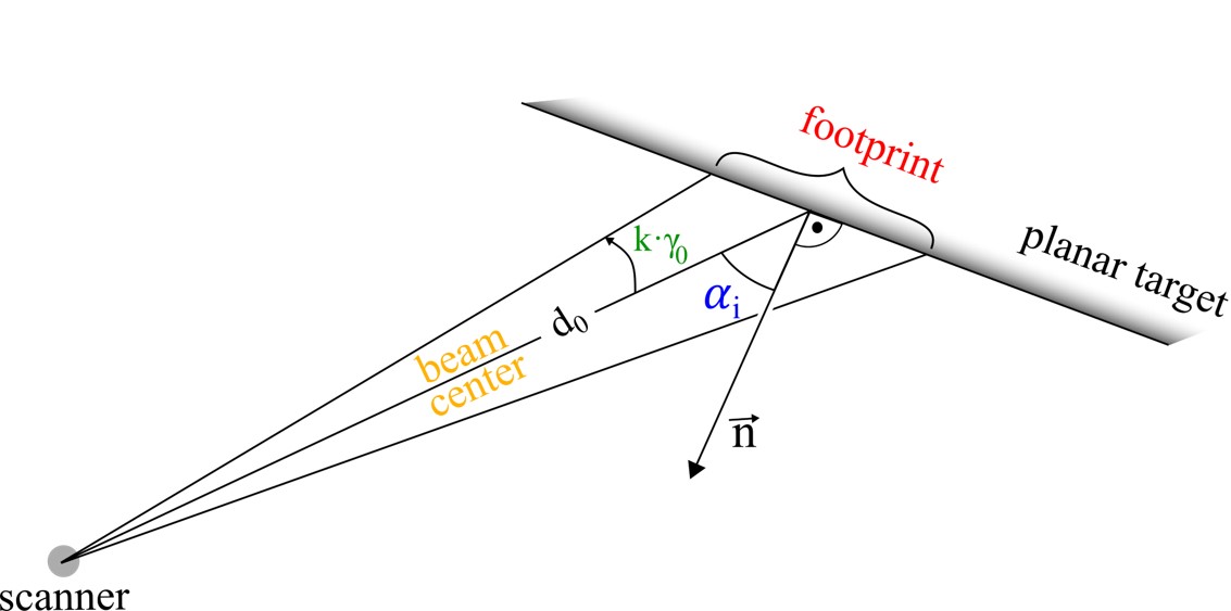
The numerical simulation framework along with examples of its application were presented in Chaudhry et al. (2019). The laser beam is modeled as a circular beam with fundamental TEM00 mode depicting a Gaussian irradiance profile (refer Figure 1). It is discretized into a configurable number of rays each of which is traced using the geometrical optics approximation. The distance along the ray is calculated by intersecting it with a 3d triangular irregular network (TIN) representing the geometrical model of the surfaces. The power associated with the ray is calculated using the LiDAR equation and a 4-parameters reflectance model of the intersected TIN elements. The 4 parameters comprise of separate attenuation factors and directivity coefficients for diffuse and specular reflections allowing to model a mixture of both ranging from purely Lambertian to purely specular. Finally, the rays are aggregated into the I and Q samples or the received signal at the detector. Simulated random noise is added to the detector output. Defining the true distance to be the one along the central ray of the beam (depicted in Figure 2), we calculate the distance error for each beam. The measurement laser beam can be deflected at incremental angular directions to extend the simulation framework to a 3d scanning process. The entire numerical simulation has been implemented in Matlab and has been executed for all numerical investigations in this project on a desktop PC for analyses with single beams, and on ETH’s HPC Euler for obtaining entire point clouds from simulated scans.


The numeric model is calibrated using experimental investigations in our geodetic metrology lab at IGP, ETH Zurich using phase-based Z+F Imager 5016 scanner. Three common surface specimens are chosen for these experiments, namely, light wood, dense wood, and concrete samples. The resulting point clouds are analyzed for the bias, noise, and angle of incidence effects with respect to the reference surface obtained using the laser tracker. The measurement setup showing the measurement setup and the dense wood specimen are depicted in the Figure 3.

The work on the modeling of the mixed pixel errors and prediction of the resolution capability in the angular direction analytically for terrestrial laser scanning is published in Chaudhry et al. (2021). In addition, our developed model requires the knowledge of the measurement beam parameters that can be taken from the data sheet of the scanner or approximated using a simple experiment. This experiment is described in the paper and the developed software for estimating the beam dimensions and beam parameters is external page provided on GitHub. The graphical abstract of the work is depicted below.

References
Chaudhry, S.; Salido-Monzú, D.; Wieser, A. Simulation of 3D laser scanning with phase-based EDM for the prediction of systematic deviations. In Proceedings of the International Society for Optics and Photonics (SPIE), Munich, Germany, 24–27 June 2019; Volume 11057, pp. 92–104.
Chaudhry, Sukant.; Salido-Monzú, David; Wieser, Andreas. 2021. "A Modeling Approach for Predicting the Resolution Capability in Terrestrial Laser Scanning" Remote Sens. 13, no. 4: 615. https://doi.org/10.3390/rs13040615.
Contact
- Location location_onHIL D 47.2
- Phone phone+41 44 633 05 55
- Emailemailandreas.wieser@geod.baug.ethz.ch
- contactsvCard Download
Geosensorik und Ingenieurgeodäsie
Stefano-Franscini-Platz 5
8093
Zürich
Switzerland